I thought you guys might like to see a couple of shots of the Bonne Carre Spillway, about 25 miles upriver from New Orleans. It was constructed after the floods of 1927 to help relieve the pressure on the levees that protect the river downriver from this spillway. They will be opening the spillway tomorrow, Monday, May 9, 2011. It will take 250,000 cubic feet per second of water and divert it into Lake Pontchartrain. According to an interview with John Barry author of
Rizing Tide a history of the 1927 flood, this is the largest flood event on the River since that date. I rode up the river road on my motorcycle to get these pictures.
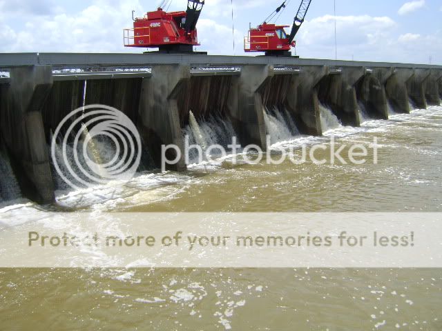
This is a view on the lake side of the spillway showing that the water is already coming through the "needles."
This is a view from the River side, I hope you can see how high the water is--it is above the surrounding ground held back only by the levees.

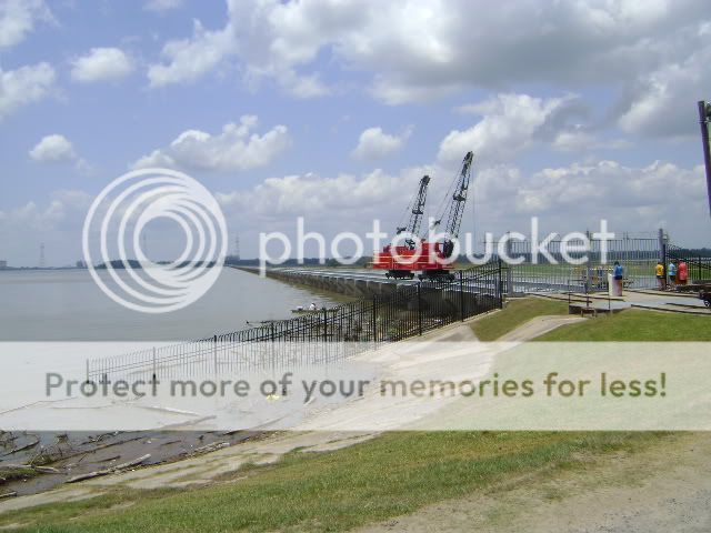
This is a panorama from the lake side that gives some idea of how big this structure is.
I was in Baton Rouge last week and parked next to the Mississippi. When I came out of the garage, I saw 40 or more men packing sandbags at a low spot in the levee. The water is supposed to crest around 5/24--and it will be nearly at the limits of the levee's capacity. Today I saw several trucks with inspectors looking for any problems with the levee system.
